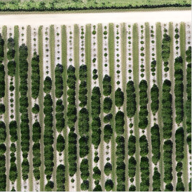
Super Resolved
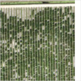
Original
Agrozoom
Drone-quality insight at plane cadence.
Drag the slider ↔ see the difference
Our proprietary Super-Resolution technology uses Generative AI to enhance image quality beyond traditional methods — making drone-equivalent images from a lower-resolution source. Lower cost, higher quality.
With Agrozoom, you can:
- Upscale low-resolution images with incredible detail preservation
- Ensure high-quality images for agricultural applications
- Complete scaled AI analysis of images — this is the BIG DEAL.
How It Works
AI-Powered Analysis
Our generative AI analyzes the input image to understand its content, identifying edges, textures, and patterns.
Detail Enhancement
The system intelligently enhances details based on learned patterns from millions of high-quality images.
Quality Optimization
Final processing ensures the enhanced image maintains natural appearance while significantly improving resolution.
Talk to a human
Tell us about your operation and we'll reach out within one business day.
Contact Information
- agroview@agintel.ai
- (352) 284-1452
- Gainesville, FL
© 2020–2026 Agriculture Intelligence, Inc. All rights reserved.